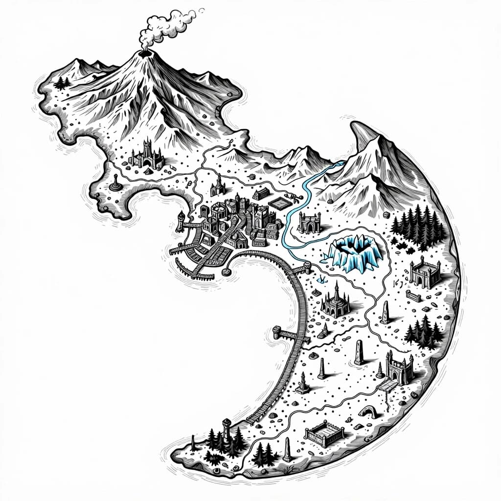
2D top-down authentic gritty dark fantasy large-scale strategic nautical map, high-detail medieval woodcut style, inspired by Tainted Grail: Fall of Avalon. Pure white background with sharp, ultra-thin black outlines, strictly borderless clean line art. The surrounding sea area is completely empty, plain, and vacant white space with fine vintage wave etching. Sharp, realistic coastlines feature smooth natural curves with blunt rounded tips and minimal, clean traditional dark fantasy cartography outline hatching to ensure clarity. The map depicts one single massive wide crescent-shaped island with a gentle curved silhouette, rendered as a detailed hand-drawn topography layout where numerous tiny points of interest are randomly scattered across its diverse territories, leaving plenty of empty space between them. At the highest peak and northern summit of the island sits a single massive smoking volcano. A detailed medieval fantasy seaport town with docks and piers is nestled inside the island's wide natural bay. Multiple winding rivers flow from the central mountains down into the sea. The rest of the island features randomly scattered landmarks including a few ruined castles, overgrown temples, abandoned cathedrals, ancient altars, swamps, ice caves, ice canyons, cursed monoliths, dark caves, burnt forests, wooden bridges, stone obelisks, rope bridges, ritual altars, lone watchtowers, deserted villages, plagued dungeons, and execution grounds. Every object, terrain line, and topographic feature is rendered exclusively as a hollow, high-contrast gritty medieval engraving line. Highly detailed masterwork.
Запрос

2D top-down authentic gritty dark fantasy large-scale strategic nautical map, high-detail medieval woodcut style, inspired by Tainted Grail: Fall of Avalon. Pure white background with sharp, ultra-thin black outlines, strictly borderless clean line art. The surrounding sea area is completely empty, plain, and vacant white space with fine vintage wave etching. Sharp, realistic coastlines feature smooth natural curves with blunt rounded tips and minimal, clean traditional dark fantasy cartography outline hatching to ensure clarity. The map depicts one single massive wide crescent-shaped island with a gentle curved silhouette, rendered as a detailed hand-drawn topography layout where numerous tiny points of interest are randomly scattered across its diverse territories, leaving plenty of empty space between them. At the highest peak and northern summit of the island sits a single massive smoking volcano. A detailed medieval fantasy seaport town with docks and piers is nestled inside the island's wide natural bay. Multiple winding rivers flow from the central mountains down into the sea. The rest of the island features randomly scattered landmarks including a few ruined castles, overgrown temples, abandoned cathedrals, ancient altars, swamps, ice caves, ice canyons, cursed monoliths, dark caves, burnt forests, wooden bridges, stone obelisks, rope bridges, ritual altars, lone watchtowers, deserted villages, plagued dungeons, and execution grounds. Every object, terrain line, and topographic feature is rendered exclusively as a hollow, high-contrast gritty medieval engraving line. Highly detailed masterwork.

Создать свою версию!